.
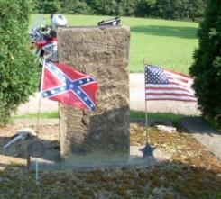
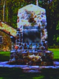
So I'm riding along and spot this monument on the side of the road. The Confederate flag must have a good story attached to it. As it turns out it does and its the tale of Morgans Raid.
On reading the marker I find out that a Confederate Cavalry Unit surrendered here. Im about to relearn some history.
.
I had pretty good history teachers along the way; but on the question of "How far North did the conferderates get ?" I was sure I had the right answer. Twenty some years earlier I was fortunate to tour Gettysburgh while in the military. For that tour we had the best ranger and guys along who really knew their history.
.
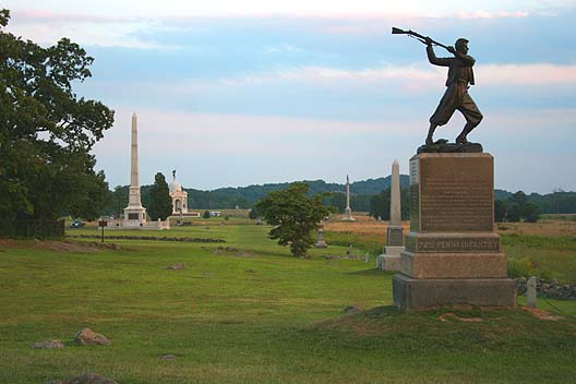
The picture at the left is cemetary ridge on the Gettysburgh battlefield. It is known as the High Water Mark of the Confederacy. Its the spot were Pickets charge stopped. This is what the history books tell you is the farthest north the Confederates got.
When I toured the battlefield I learned that there was a skirmish on Camp Hill a few days before. Camp Hill is north of Gettysburg that represented the most northern battle of the war.
.
As I'm reading the monument I realize Im about 20 miles north of Camp Hill. So I mark the spot in the GPS and take a few pictures. As I ride off Im thinking about Gettysburgh and this new marker and I cant forget it. So I head into town and find the library, they direct to the local historical society and I get the story.
.
The answer to "How far north did the Confederates get during the Civil war ?" is Salineville Ohio.
Lees Army made it to Camp Hill. But John Hunt Morgan penetrated to Salineville.
.
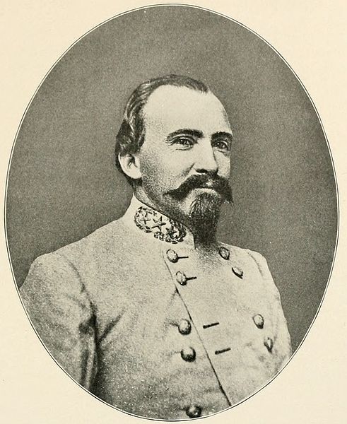
General Morgan is pictured on the left. His raid on Indiana, Kentucky and Ohio was designed to basically scare the locals and tie up troops in the region. Imagine looking out your window and seeing an invading army. You are going to wonder where your National Guard is.
As with all good stories this one has a few problems. Morgan was under direct orders not to cross the Ohio river. After he exceeded his orders he was trying to get back across.
.
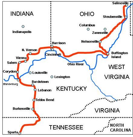
Morgan had already crossed the Ohio river and ran through Indiana before he entered Ohio near Cincinnati. For the rest of the raid he was trying to get back across the river. Along the way he cut telegraph lines, stole horses and generally caused problems. During the first part of the raid he encoutered very little resistance. However by the time he reached Nelsonville he had several Ohio Volunteer Infantry units on his tail. Both future Presidents McKinly and Hayes chased Morgan.
.
Morgan tried to cross the Ohio river at Buffington Island and it was here that his luck ran out. His unit was scattered and only a few men escaped.
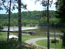
The battlefield park at Buffington Island has many markers to mark the battle. There is also an Indian Mound on the site. Its a nice place for a picnic or to just explore.
To learn about the battlefield follow this link http://ohsweb.ohiohistory.org/places/se03/
.
The remainder of Morgans troops crossed The Muskingham River south of Zanesville and headed north looking for another place to ford the Ohio River.
Today the Muskinghum River Watershed has parks at each of the lock and dam structure. I have ridden the entire route and it is one of the nicest park systems in the state.
To learn more check out http://www.dnr.state.oh.us/Portals/4/pdfs/access/muskingumrwt.pdf
.
After Crossing the Muskingum Morgan continued north in an effort to get across the Ohio. He was chased north to Salineville where a final battle ensued. Morgan then went south to West Point where he surrendered. He was sent to the Ohio Penitentiary where he proceeded to escape. Upon his return to the Confederacy he was greeted as a hero; however he was assigned to menial duties. The General who issued the order not to cross the Ohio never really trusted him again.
.
.
Here are some links for Morgans Raid
http://en.wikipedia.org/wiki/Morgan's_Raid
This one has the original Harpers Weekly newspaper accounts of the raid.
http://www.sonofthesouth.net/leefoundation/civil-war/1863/john-morgan-raiders.htm
Numerous markers on the Remarkable Ohio website show the route.
http://www.ohiochannel.org/your_state/remarkable_ohio/marker_details.cfm?marker_id=8601
http://www.ohiochannel.org/your_state/remarkable_ohio/marker_details.cfm?marker_id=14
http://www.ohiochannel.org/your_state/remarkable_ohio/marker_details.cfm?marker_id=15
http://www.ohiochannel.org/your_state/remarkable_ohio/marker_details.cfm?marker_id=316
http://www.ohiochannel.org/your_state/remarkable_ohio/marker_details.cfm?marker_id=531
http://www.ohiochannel.org/your_state/remarkable_ohio/marker_details.cfm?marker_id=617
http://www.ohiochannel.org/your_state/remarkable_ohio/marker_details.cfm?marker_id=335
http://www.ohiochannel.org/your_state/remarkable_ohio/marker_details.cfm?marker_id=336
http://www.ohiochannel.org/your_state/remarkable_ohio/marker_details.cfm?marker_id=346
http://www.ohiochannel.org/your_state/remarkable_ohio/marker_details.cfm?marker_id=345
http://www.ohiochannel.org/your_state/remarkable_ohio/marker_details.cfm?marker_id=347
http://www.ohiochannel.org/your_state/remarkable_ohio/marker_details.cfm?marker_id=499
http://www.ohiochannel.org/your_state/remarkable_ohio/marker_details.cfm?marker_id=106041
http://www.ohiochannel.org/your_state/remarkable_ohio/marker_details.cfm?marker_id=497
http://www.ohiochannel.org/your_state/remarkable_ohio/marker_details.cfm?marker_id=447